New Mexico Equestrian
Sandia Mountain - Cienega Equestrian Trailhead

As the summer begins to wind down, days are feeling just a bit shorter, and the oppressive heat we’ve experienced for the past couple of months is easing, I’m thinking of some my favorite local riding areas. From my location in the East Mountains, the closest place I go to with some regularity is the Cienega Equestrian Trailhead in the Cibola National Forest on east side of the Sandias. Commonly referred to as the “Cienega Horse Bypass,” this trailhead offers convenient access to numerous trails in the Sandias, is an easy drive from both Albuquerque metro and Santa Fe areas, and is a really nice alternative to the high desert juniper-and-sage rides that many of us in New Mexico are used to.
Why it is noteworthy:
The Cienega Equestrian Trailhead is on the east side of the Sandias and is easily accessible from NM 536, aka the Sandia Crest Road, about 30 minutes from SE Albuquerque or about 50 minutes from SW Santa Fe. Well-marked trails take riders through varied mountain terrain with cooler temperatures due to the area’s elevation and ample shade provided by the surrounding mixed conifer forest. The trails offer gorgeous scenery of the mountain itself as well as stunning views of the surrounding Ortiz, San Pedro, Manzano, Jemez and Sangre de Cristo mountains and valleys. Keep an eye out for the local flora and fauna, including a wide variety of wildflowers, songbirds, deer, Abert’s squirrels, and the unique alligator juniper trees with thick, checkerboard-like bark that resembles alligator skin!


Facilities and Directions:
The moderately-sized gravel parking area provides room for 3-5 trucks and trailers to park next to one another, with additional room for a rig or two to park parallel to the low perimeter fence. Vault toilets are available at the equestrian trailhead as well as at the Cienega picnic area nearby. No potable water is available. The required $5 per day use fee can be paid at the self-service drop box on site or you can pre-purchase a pass online at www.recreation.gov to print out ahead of time and put in your window. Alternately, you can use your New Mexico Enchantment Pass or America the Beautiful National Parks Pass for access. For more information, see https://www.fs.usda.gov/r03/cibola/passes

Please note that although the Forest Service website states that this trailhead is open year-round unless winter weather conditions are present, my experience is that the gate on FSR 190 is typically closed and locked from fall through spring. If you want to ride from the Cienega Equestrian Trailhead any time between October and May, I highly recommend that you call the Cibola National Forest Tijeras Ranger Station first at 505-281-3304 (also see link in Resources section below) to verify whether or not it is accessible.

From Albuquerque, take I40 East and then exit onto NM 14 at Tijeras, heading north. Stay on NM 14 for approximately six miles, until you reach the new traffic circle in Sandia Park. At the traffic circle, take the third exit which puts you onto NM 536 / Sandia Crest Road. Stay on Sandia Crest Road for approximately 1.5 miles and then turn left at the Cienega/Sulphur Canyon Picnic Area sign. You’ll want to go slowly as you approach this turn, as it can be hard to see at first. Immediately after turning left off of the Crest Road, take another left turn onto FSR 190 and go through the gate toward the Cienega Picnic Area and Horse Bypass. This road is fairly narrow and a bit steep, so keep right and go slowly. As you reach the top of the short hill (about ¼ of a mile from your turn), turn left again onto a gravel road with signs pointing to the equestrian parking area. After about 200 yards of so, you’ll see the parking area which can fit 5-6 trucks and trailers if everyone parks thoughtfully.
From Santa Fe, take NM 14 south for approximately 50 miles, to Sandia Park. At the new traffic circle in Sandia Park, take the first exit which puts you onto NM 536 / Sandia Crest Road. Stay on Sandia Crest Road for approximately 1.5 miles and then turn left at the Cienega/Sulphur Canyon Picnic Area sign. You’ll want to go slowly as you approach
this turn, as it can be hard to see at first. Immediately after turning left off of the Crest Road, take another left turn onto FSR 190 and go through the gate toward the Cienega Picnic Area and Horse Bypass. This road is fairly narrow and a bit steep, so keep right and go slowly. As you reach the top of the short hill (about ¼ of a mile from your turn), turn left again onto a gravel road with signs pointing to the equestrian parking area. After about 200 yards of so, you’ll see the parking area which can fit 5-6 trucks and trailers if everyone parks thoughtfully.

Trails description:
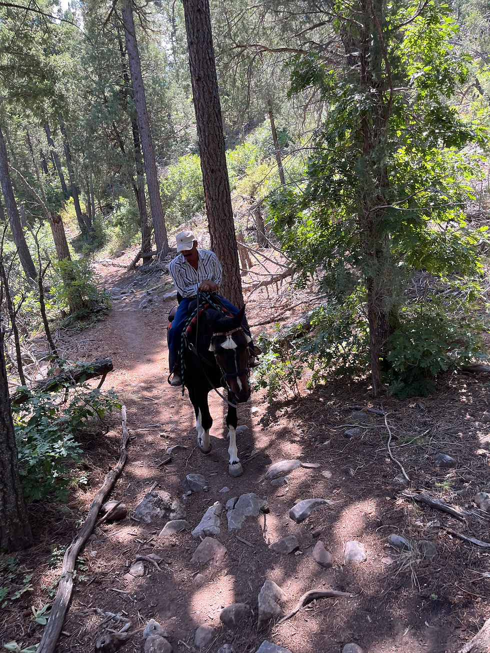
This single-track, multi-use mountain trail system includes a wide variety of footing, from smooth, well-packed dirt trails to more technical and rocky sections. Although well-seasoned barefoot horses with tough feet may do fine on these trails, I recommend anyone visiting for the first time has good hoof protection for their horses.
As this is a multi-use area, expect to see a variety of other trail users including tourists who may not be familiar with horses or who don’t understand standard trail etiquette and right-of-way with horses. When approaching other trails users, remember to announce yourself/say hello and let them know how best to give you and your horses safe passage.

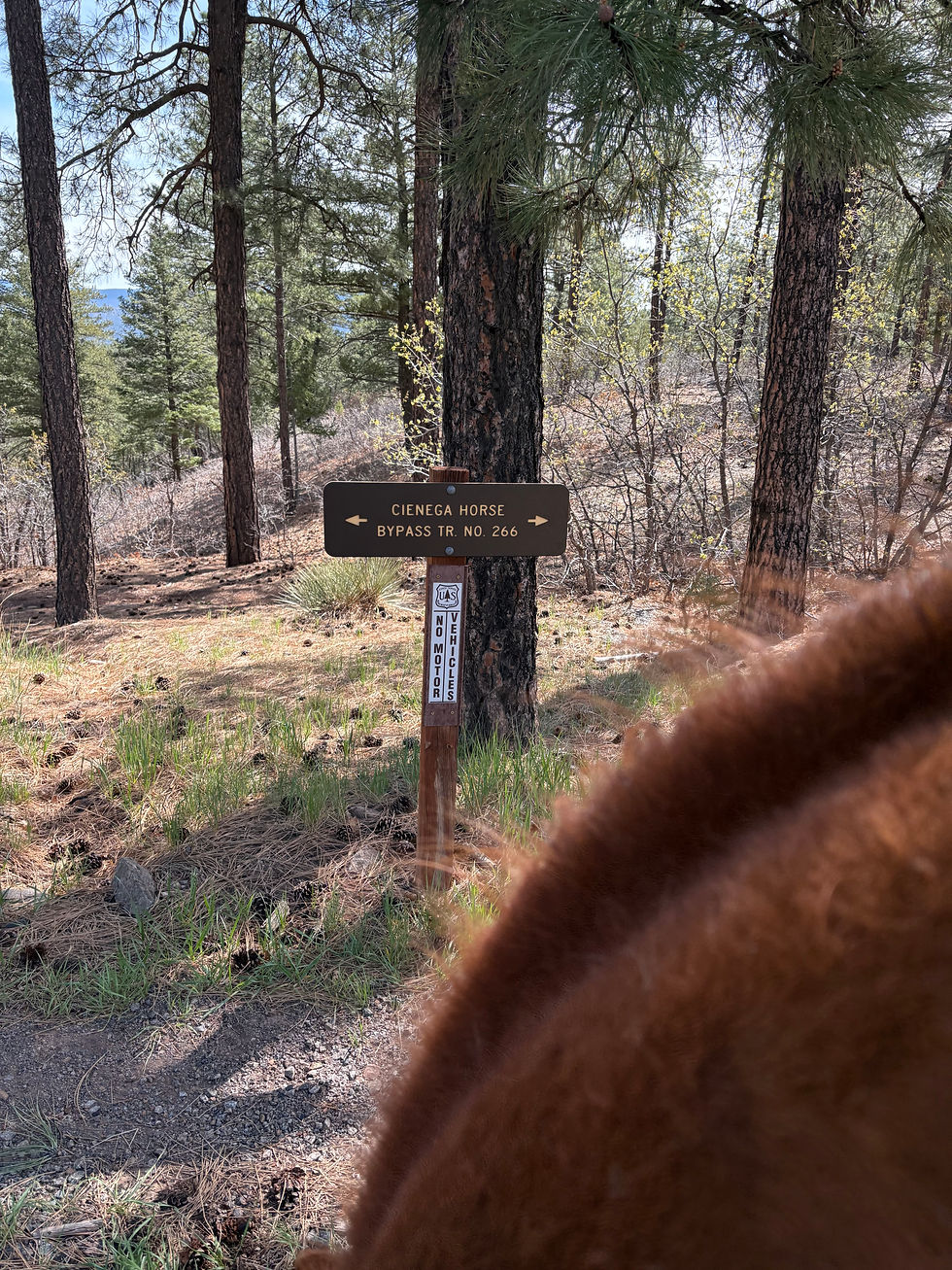
When you are ready to ride out from the parking area trailhead, you have several options. Passing through an opening in the low perimeter fencing on the east side of the parking area leads to Cienega Horse Bypass Trail #266, which wanders over a small ridge and then down to the old Cienega access road, Cienega Spring Trail #148, and Armijo Trail #222. Your other option for leaving the trailhead is to ride out on the gravel access road that you drove in on, then cross the paved road (FSR 190) and either head west up the mountainside, also on Cienega Horse Bypass Trail #266, or south, parallel to the paved road on your left, along a narrow trail that winds down to the main Cienega picnic area.
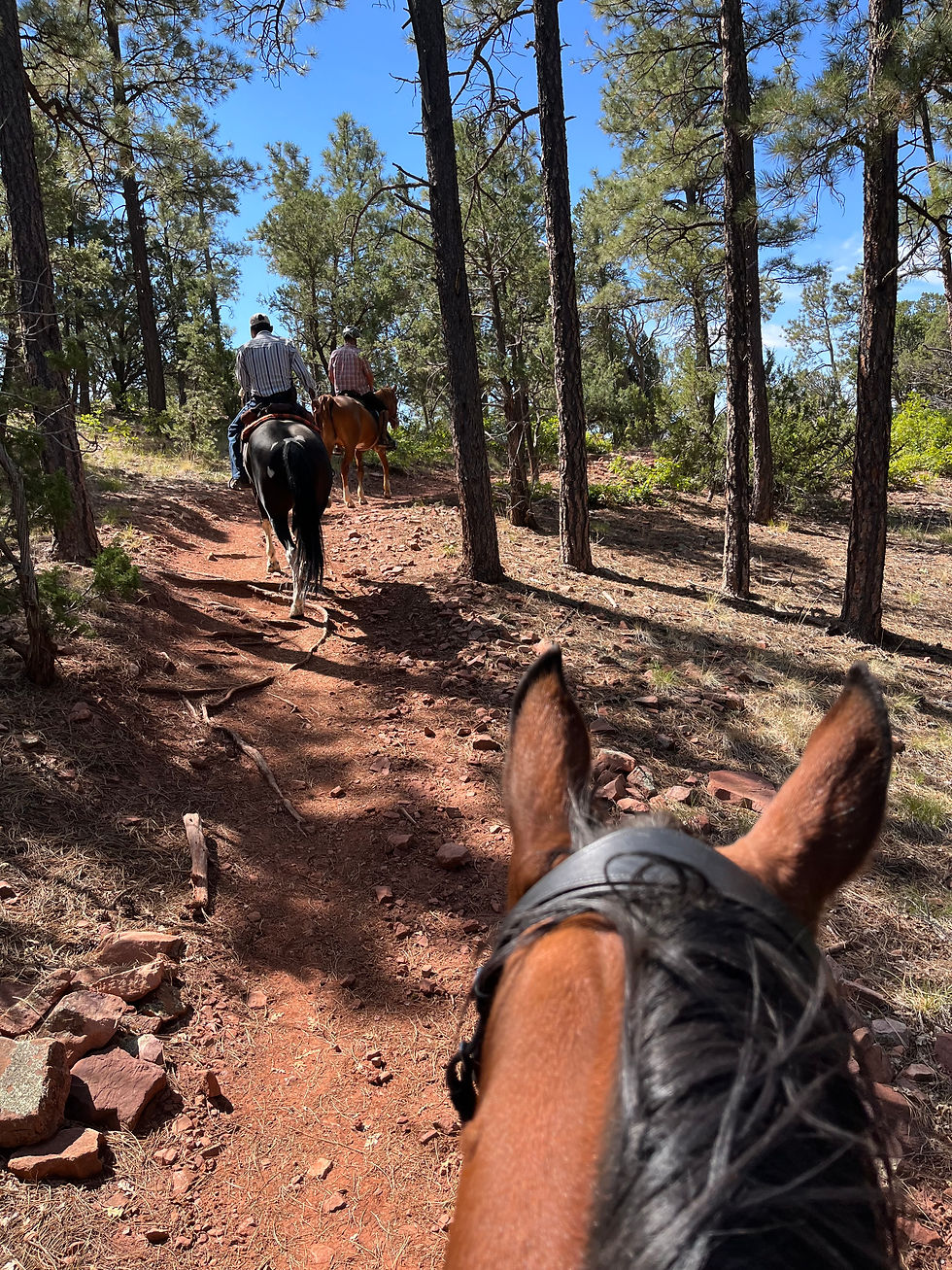
A nice loop ride that covers about 5.5 miles and takes, on average, about 2.5 to 3 hours to complete, is to ride out east on Cienega Horse Bypass Trail #266 for about 0.5 miles to Armijo Trail #222, then follow Armijo for about 2 miles to its intersection with Faulty Trail #195. At the intersection, turn right and follow Faulty Trail #195 for approximately 2 miles, then turn back onto Cienega Horse Bypass Trail #266, which will lead you back down to the trailhead. This loop is all singletrack (save for a couple of hundred yards on the access roads) and includes a few sections that are open and smooth enough for trotting. Other sections are narrower with limited visibility, so keep an eye out for other trail users such as hikers, trail runners, and mountain bikers who may not be aware that there are horses on the trail with them. Also be on the lookout for several especially rocky sections along Faulty Trail, one of which involves a somewhat tricky rock ledge at about mile 3.8 that is safer to dismount and lead your horse through as the rocks are slick for the horses.

Beyond the loop described above, there are many new trails that diverge from Armijo Trail and lead to the residential areas bordering the National Forest. These can be fun to explore but keep in mind that you’ll probably end up turning around and backtracking to the main trail as they typically do not intersect elsewhere. You can also choose to access other parts of the mountain by riding further north or south on Faulty Trail or by taking other connecting trails. If you plan to explore, it is definitely worth investing in a formal USFS trails map, a good guide book to trails of the Sandias, and/or a reliable trails app such as All Trails, Gaia, Strava, CalTopo, or EquiLab.
Why It’s Worth Going:
Riding on the Sandia Mountain trails is a wonderful way to beat the heat during the summer months and to enjoy mountain riding close to home. The trails are well-maintained and clearly marked making them easy and fun to navigate for new visitors and regulars alike, and the trailhead is easily accessible from NM 14.
This is the primary equestrian access point for the Sandia trail system and the Sandia Mountain Wilderness, providing dedicated parking for trucks with trailers and safe space for loading and unloading horses. While there are several other locations that riders sometimes park and ride from on the mountain, none are set up specifically for equestrian use and none offer the same level of safety and accessibility that the Cienega Equestrian Trailhead does.
Now go ride!

Resources:
USFS Cienega Equestrian Trailhead: https://www.fs.usda.gov/r03/cibola/recreation/cienega-equestrian-trailhead
Basic USFS Map of Sandia Mountain Trails: https://www.fs.usda.gov/sites/nfs/files/legacy-media/cibola/Sandia%20Mountain%20Trails%20Brochure%202021.pdf
Cibola National Forest Tijeras Ranger Station: https://www.fs.usda.gov/r03/cibola/offices/sandia-ranger-district
Here are some TL;DR insights:
If planning to ride from the Cienega Equestrian Trailhead from October to May, call the Cibola National Forest's Tijeras Ranger Station first to make sure that the access road is open.
Cienega Equestrian Trailhead is in the Cibola National Forest and many of the trails in the area lead into the Sandia Mountain Wilderness. No motorized or chain-driven vehicles of any kind are permitted in Wilderness areas, including mountain bikes.
The trailhead sits at just over 7,000’ elevation and most trails go up from there, some reaching 10,000’ or more. Trails can be rocky, steep, and technical in places. Be sure you and your horses are ready for this kind of terrain before you go and be aware that those from lower elevations may need time to acclimate.
Day use fee is $5 per vehicle unless you have a recognized annual recreation pass.
Take water for both people and horses as it isn’t available at the trailhead and seasonal sources on the mountain itself are unreliable.
Take bug spray and sunscreen. You will use it.
The trail system out of the Cienega Equestrian Trailhead is well marked but be sure you have some sort of map of the area in case you get turned around or decide to change plans mid-ride.


Comments